Share

Scan the QR code and open PeakVisor on your phone
Scan the QR code and open PeakVisor on your phone
The Golden Gate National Park is a stunning South African park near the border with Lesotho. There are six named mountains in Golden Gate Highlands National Park; the highest and most prominent is Ribbokkop (2,826 meters / 9,272 ft).

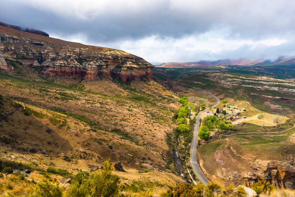
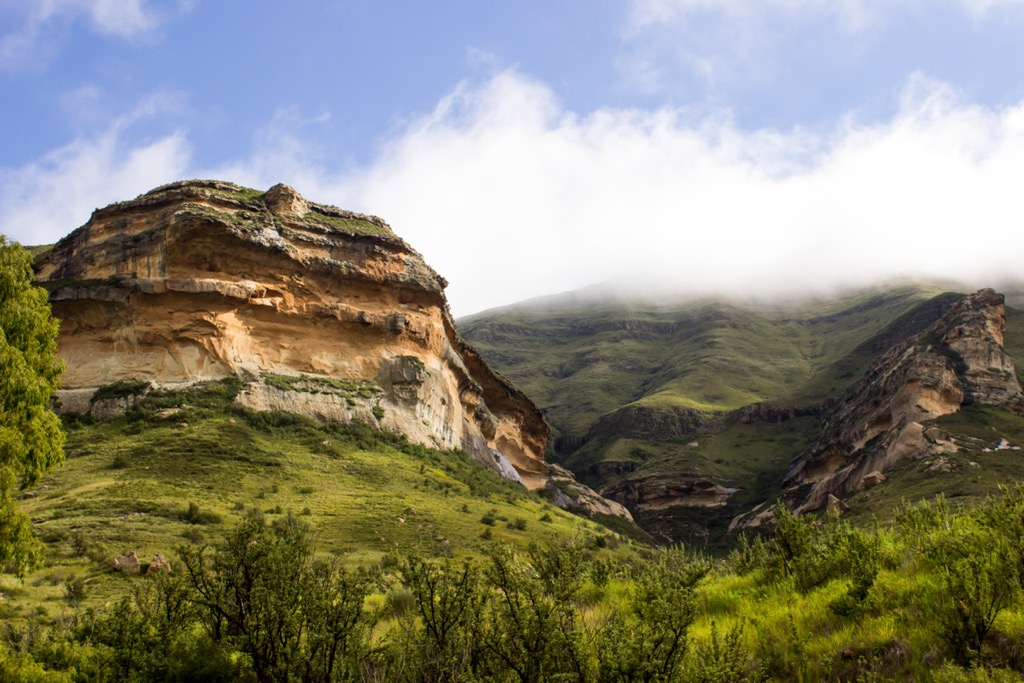
The Golden Gate National Park, situated in the Free State province of South Africa, is renowned for its golden-hued sandstone cliffs and outcrops, which give the area its name. It covers an area of 34,000 ha (84,106 ac) and features diverse landscapes, from grasslands to canyons and a rugged escarpment.
The complex interactions of tectonic forces, climate, and erosion shape the park’s landscape. Positioned on the eastern fringes of the African Plate and gradually distancing itself from the Antarctic Plate, the park occupies a rift valley filled with sedimentary rocks like sandstone, shale, and mudstone. These rocks, deposited over millions of years by ancient rivers and lakes, house a rich array of dinosaur and plant fossils.

The Maluti Mountains, part of the Drakensberg, intersect the Golden Gate Highlands National Park. These mountains are the result of volcanic activity about 180 million years ago when the supercontinent of Gondwana began to break apart. The lava flows and ash deposits formed basalt, a dark and hard rock that caps the sandstone. The basalt protects the underlying rocks from erosion, creating flat-topped hills and plateaus.
Elevation and location significantly influence the park's climate, ranging from 1,800 to 2,826 meters (5,905 to 9,272 ft), making it one of the highest national parks in South Africa. The park experiences a temperate climate, with warm summers and cold winters. The park’s average annual rainfall is 800 mm (31 in), mostly between October and April, and is prone to thunderstorms, hail, and snow.
The Golden Gate Highlands National Park has a rich geological history, with three main rock layers formed over millions of years by different environmental conditions.
The bottom layer is the Elliot Mudstone Formation, which consists of silt and mud deposited when the area was a wetland or floodplain about 200 million years ago. Grassy slopes cover this layer, which is not very visible in the park.

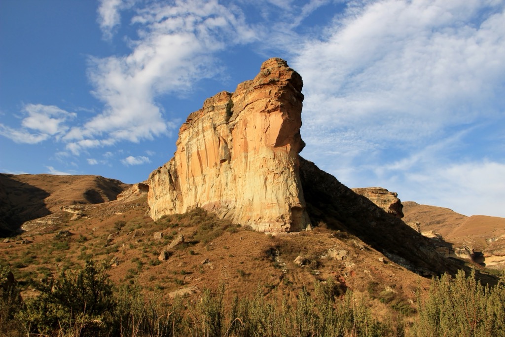
The middle layer is the Clarens Sandstone Formation, which is the park's most prominent and characteristic feature. This layer was formed when the area became a desert about 190-196 million years ago, and sand dunes accumulated over time. The sandstone is weak and easily eroded by wind and water, creating the park’s spectacular namesake cliffs and formations.
The top layer is the Drakensberg Basalt Formation, a relatively hard and dark rock formed by volcanic activity about 183 million years ago. Sheets of molten lava covered the sandstone layer and solidified into basalt. The basalt is resistant to erosion and forms the highest peaks and plateaus in the park, such as Ribbokkop. The basalt also metamorphosed the sandstone layer underneath it, producing quartzite, a stronger and more crystalline rock.

The park has diverse habitats, from highveld and montane grasslands to Afromontane forests and alpine tussock grasslands. Its vegetation exhibits adaptability to varying soil, moisture, and temperature conditions. With more than 60 grass species and a rich assortment of bulbs and herbs, the park is a crucial food source for numerous herbivores.
Notably, the presence of patches of Afromontane forest, a rarity in South Africa, adds to the park's ecological significance. These forests harbor endemic and endangered species, including the bald ibis, Cape vulture, and mountain rhebok. Additionally, the park features alpine grassland above 2,400 meters (7,874 ft), fostering distinctive flora and fauna.

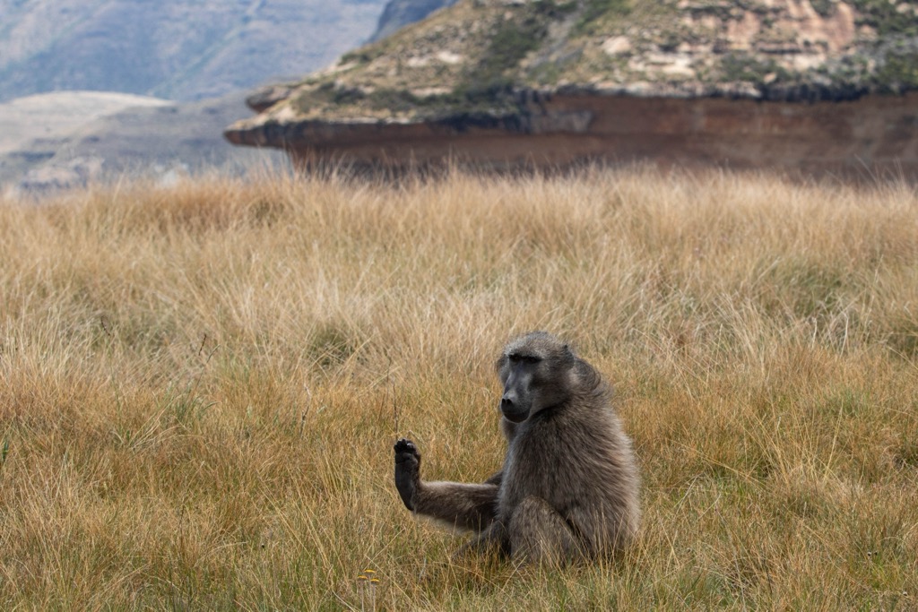
The park is home to many mammals, including eland, blesbok, reedbuck, oribi, wildebeest, springbok, zebra, and mongoose, although it lacks large predators. The park provides a habitat for over 100 bird species, including bearded and Cape vultures, Verreaux’s eagle, bald ibis, and the orange-breasted rockjumper. Notably, the park houses several caves and shelters adorned with San rock paintings and palaeontological sites revealing dinosaur eggs and skeletons.

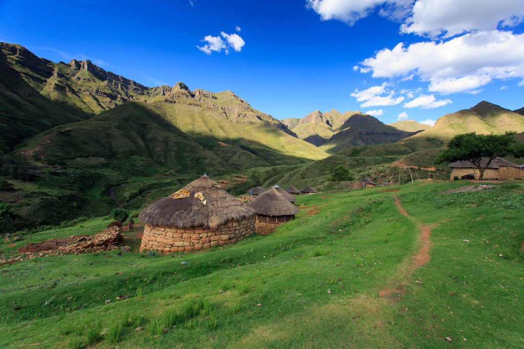
The Golden Gate Highlands National Park has a significant human history, tracing its roots to the ancient Khoisan people, whose past endures in the form of stone tools and rock paintings found in protected overhangs within the park.
Subsequently, the park became a habitat for the Basotho people, who fought with European settlers over territorial claims. In 1875, the name ‘Golden Gate’ was bestowed upon the area by J.N.R. van Reenen, a farmer who was impressed by the glow of the setting sun on the cliffs.
Formally designated as a national park in 1963, its primary objective was to conserve its natural allure and diverse ecosystems. Over the years, the Golden Gate Highlands National Park underwent expansions, culminating in a merger with QwaQwa National Park in 2007.

The Ribbokop Hiking Trail is a two-day, 28 km (17 mi) circular route that involves some steep ascents and descents, crossing streams and rock pools, and reaching the highest point in the park, Ribbokkop.
Along the way, hikers enjoy views of the sandstone cliffs and formations, the grasslands, and the valleys. Commencing and concluding at the Glen Reenen Rest Camp, the trail begins with a 16 km (10 mi) hike on the initial day leading to Ribbok Hut. The subsequent day involves a 12 km (7 mi) trek to the summit of Ribbokkop before returning to the rest camp.
The Wodehouse Kop Trail is a 9 km (5.5 mi) circular loop with an elevation gain of 730 meters (2,395 ft). The trail starts from either the Glen Reenen Rest Camp or the Golden Gate Hotel and follows a well-marked path through the scenic landscape of the park.
Notable features along the route include the Brandwag Buttress and the Mushroom Rock, both well-known rock formations adored by park visitors. The trail then ascends to the summit of Wodehouse Kop, where hikers can observe views of Witkop and Silasberg. The trail also offers opportunities to spot wildlife like zebras, wildebeests, elands, and mountain reedbuck.
The Ribbok Hiking Trail is a two-day, 31 km (19 mi) circular route that explores mountain landscapes, streams, waterfalls, and rock pools. On the first day, hikers cover 16 km (10 mi) of mostly flat terrain, following the Little Caledon River and passing by impressive sandstone formations that the park is known for.
On the second day, hikers face a more challenging 15 km (9 mi) route, with a steep ascent of 1,000 meters (3,281 ft) to the summit of Generaalskop. From the top, hikers can admire the panoramic views of the Maluti Mountains and the border between South Africa and Lesotho, as well as Ribbokkop, Snow Hills, and the park’s Red Mountains.

Brandwag Buttress Trail spans a distance of 2.4 km (1.4 mi) and typically requires approximately one hour to complete. Designated as a moderate trail, it features segments with noticeable inclines, necessitating fixed chains for additional support.
The trail commences at the Glen Reenen Rest Camp and concludes at the summit of Brandwag Buttress, a prominent and easily recognizable landmark within the park. Hikers can enjoy panoramic views of the sandstone cliffs throughout the trail while traversing through scenic grasslands replete with wildflowers.

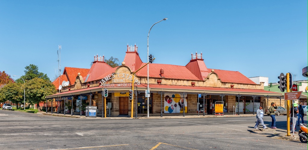
Clarens is a farming settlement situated in the foothills of the Maluti Mountains and nicknamed the Jewel of the Eastern Free State. Renowned for its artistic community, the village attracts well-known artists who reside in or regularly visit the area.
There are numerous art galleries, boutiques, craft stores, and restaurants in the town, selling a variety of artworks, clothing, jewelry, and local delicacies. Visitors can also sample local beers and wines at the Clarens Brewery and the Brambleberry Farm.

The Ash River, which flows across the city, has grade 3 and 4 rapids ideal for white water rafting. Visitors can also try other adventure activities such as ziplining, quad biking, abseiling, paintball, and archery.
Clarens Golf Estate offers an 18-hole golf course, a clubhouse, a restaurant, and a pro shop. Visitors can also stay in one of the villas or chalets on the estate.

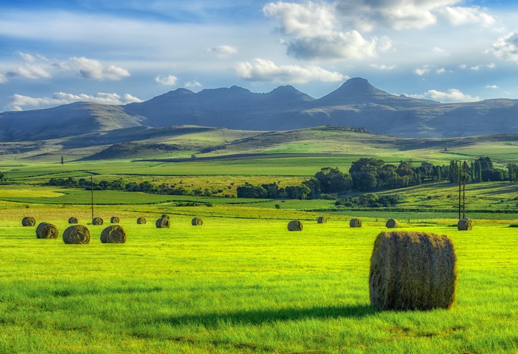
Bethlehem is a city in the eastern Free State province, situated on the Liebenbergs River along a fertile valley just north of the Rooiberg Mountains. It is named after the biblical Bethlehem, meaning ‘house of bread,’ because of its wheat production.
Visitors can learn about the cultural heritage of the Basotho people at the Maluti Cultural Village. Traditional huts and artifacts give visitors a glimpse into the lifestyle and traditions of this ethnic group.
Titanic Rock offers panoramic views of Bethlehem and is a popular spot for outdoor enthusiasts and photographers.
Finally, the Lionsrock Big Cat Sanctuary in Bethlehem is home to many big cats, such as lions, tigers, and leopards. You can take a guided tour of the sanctuary and learn about the animals and their habitats.


Explore Golden Gate Highlands National Park with the PeakVisor 3D Map and identify its summits.