Download the free Kindle app and start reading Kindle books instantly on your smartphone, tablet, or computer - no Kindle device required.
Read instantly on your browser with Kindle for Web.
Using your mobile phone camera - scan the code below and download the Kindle app.


Additional Details

Small Business
Shop products from small business brands sold in Amazon’s store. Discover more about the small businesses partnering with Amazon and Amazon’s commitment to empowering them.
Small Business
This product is from a small business brand. Support small.

Book recommendations, author interviews, editors' picks, and more. Read it now
Frequently bought together
$12.90
Get it May 28 - Jun 3
In Stock
Total price:
To see our price, add these items to your cart.
Choose items to buy together.
Similar items that may deliver to you quickly
Page 1 of 1 Start overPage 1 of 1


Top reviews from the United States
There was a problem filtering reviews right now. Please try again later.


Top reviews from other countries

Helen
Good modern map
Reviewed in the United Kingdom on February 16, 2023Color: 18x22 LaminatedVerified Purchase
J. A. Delsol
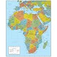
african map
Reviewed in the United Kingdom on June 27, 2023Color: 18x22 LaminatedVerified Purchase
Jamie Shotter
Handy indicative map - but not very accurate
Reviewed in the United Kingdom on January 7, 2022Color: 18x22 LaminatedVerified Purchase
FastReader
Not laminated
Reviewed in the United Kingdom on July 15, 2023Color: 18x22 LaminatedVerified Purchase
Mr D.
Good Quality - Unfortunate Oversight
Reviewed in the United Kingdom on January 29, 2022Color: 18x22 LaminatedVerified Purchase
