Whether you grew up in Gonubie, had memorable family holidays, or Sunday visits to this wonderful town, it has always been a very special place. Having grown up in Gonubie, I wanted to capture and preserve its history for future generations, and to express my appreciation to a town that will always be very dear to me.
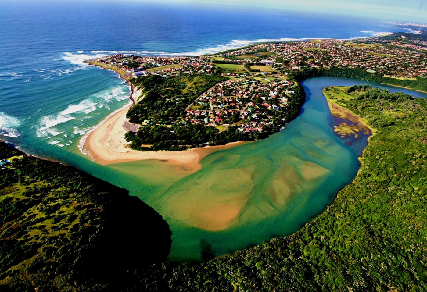
Gonubie is a seaside town at the mouth of the Gonubie River. It is situated approximately 21km North-East of East London (Buffalo City) in the Eastern Cape province of South Africa. The history of Gonubie is both rich and distorted. Gonubie boasts a rich history in that its narratives date back to the early Khoisan and Xhosa inhabitants of the area (Mfundiso Mahlasela and Gary Minkley, 2006). In fact, the name Gonubie itself is an altered form of the original word “Gqunube”.
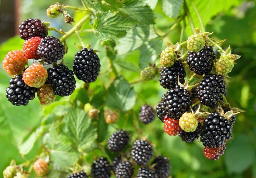
The specific language of origin of the name has been disputed (Source: “Origin of Gonubie’s name is wrong – claim”, Daily Dispatch, 25th April, 1985). Although the long standing view holds that the name is of Xhosa origin, another view, based on lexicology (the study of the form, meaning, and behaviour of words), contends that the name is of Khoi origin. “It has traditionally been considered that the name was derived from the brambling bush called Royena with its small yellow flowers. The bush grew in profusion along the banks of the Gonubie River and produced sweet, juicy berries which were much sought after by the local Xhosa inhabitants who named the area Gqunube, the Xhosa name for berry” (Bwalya, 2011, p.119). “Legend has it that the area was once covered by brambleberries. Various forms of human activities, including gathering, hunting, farming, mining and settlement led to the disappearance of these valued berries. Their legacy, however, survived these human interventions” (Mfundiso Mahlasela and Gary Minkley, 2006).
Gonubie is first mentioned in recorded history in 1752, when Ryk Tulbagh (Governor of the Dutch Cape Colony) sent an Ensign named August Frederik Beutler up the East Coast to report on the tribes living along the route, the possibility of trade and on anything else that might be profitable to the Dutch East India Company. The expedition lasted 8 months from 29 February to November, and extended eastward from Cape Town as far as the present-day location of Butterworth. This movement inland and up the coast came as a prelude to the Great Trek. Beutler records having crossed what must today be the Berlin Flats. He also records (in Dutch) his impressions of the Gonubie River Mouth and tells of having a hippopotamus shot for provisions. Doubtless Gonubie had been visited by ship-wrecked sailors several times, as through the years many ships foundered along this surf-pounded coast (Source: old newspaper article entitled; “JUST THE BERRIES AND A LITTLE BIT OF HISTORY…..”).
The next mention of Gonubie in historical records might be the occasion in 1862 when the Lieutenant General of Territories of British Kaffraria granted farm number 188 to Duncan Mackintosh in lieu of service. From January 1863, Mackintosh was required to pay 4..1..0 pounds per annum to lease the property of 2024 acres. The land was bordered by the river banks on one side and by the farm of the Rieger Brothers to the west.
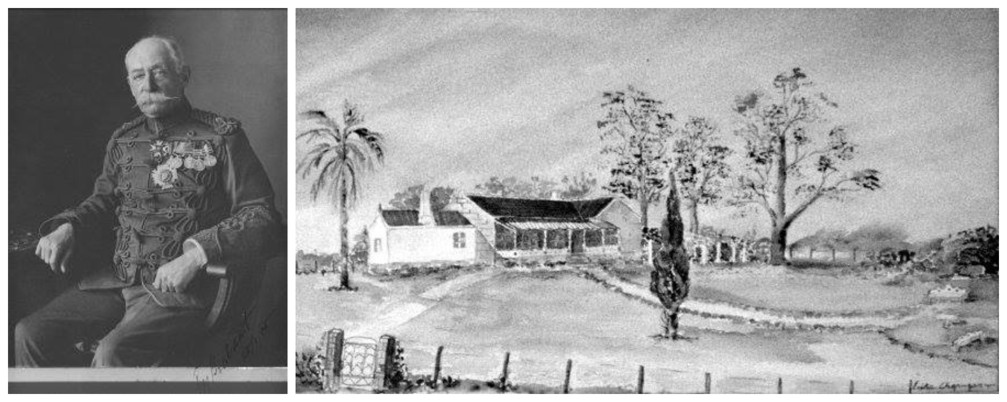
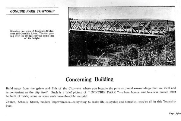
In 1869, Sir Edward Yewd Brabant (major-general in the British Army (Empire)) bought the farm for £4000. He built “Gonubie Park” with the idea of making it a sort of seaside resort for the (Cape Mounted) regiment. The farm was his home for more than thirty years. He built the house, which still stands today, from timber salvaged from the wreck of the Quanza, having bought the ‘right of the beach’ to have whatever floated ashore. It is said that the beams of the roof were cut from the masts of a ship wrecked at Eastward Ho (Source: “JUST THE BERRIES AND A LITTLE BIT OF HISTORY…..” and ‘BLAMING BRABANT’ Another look at the so-called military ‘disobedience’ of Captain, Later Major-General Sir Edward Yewd Brabant, KCB,CMG).
Through my research it was identified that the history of Gonubie is distorted in that, as is the case with most of written South African history, it represents mostly the narratives of European settlers and their descendants. According to Gail Bean, this may be owing to the fact that the traditions of the natives were based on patriarchal lore, where information and stories are passed down from father to son or mother to daughter. It is important to make this point because Europeans came with the schooling and histories, etc. of the Northern Hemisphere and the well heeled and educated amongst them kept diaries and passed this information back to the friends and family they left behind, which is why we have this view of recorded history today. This does not mean that the “natives” they found did not have a similar system, simply that they preferred to convey it differently. Traditionally this is why the various customs took place when couples wished to marry for example and why ancestry is still as important to them as it is to us. isiduko resides in the memories of the elders usually males but also females. The recolonization of the Europeans and imposition of what was familiar in terms of laws and acquired skills was part fear resulting in self defense by superior arms. Sadly many of the natives elders lost their lives and with them went some of their vital history. Without dwelling extensively in pre-colonial and colonial history, it is important to note the following:
“The last and ninth frontier war saw mass migration of natives to the lands across the Kei River. Thus ‘creating space’ for European settlers. Historical records show that this war between the invading European settlers and retreating Xhosa natives was fought in 1877- 1878 in and around Komga (Qumrha). Gonubie was first formally settled by Europeans in 1877 under a scheme known as the Kaffrarian and Border Immigration Society. As with the general history of South Africa, in particular that of the frontier areas of the Eastern Cape, natives in and around Gonubie faced many challenges. After their ancestors were forcibly moved to the impoverished and overcrowded areas of the former homelands of Transkei and Ciskei, natives had to ‘come back’ to earn a living as farm workers, child minders, house-keepers and general workers.” (Mfundiso Mahlasela and Gary Minkley, 2006). Rich and intriguing as the history of Gonubie may be, it is important to remember the struggles and hardships of the natives that originally occupied this land.
The first church in Gonubie was built on the eastern side on the Gonubie River by Presbyterian settlers in 1902 (Whitfield, 1979). This church, which still stands today, was used both as a place of worship and final resting place.
In 1927 the township was registered for the first time.

Photo credit: Jenny Balson
“Gonubie Mouth Primary School came into existence in January 1930 with Miss V. Egelhof as the first teacher. A banana ripening shed, belonging to Mr Leopold (Louis) Rosenbaum, was used until a classroom was built. There was an enrolment of 30 pupils.” (Source: A brief history of Gonubie Primary School). According to Sigi Howes, “Although the present Presbyterian Church at Gonubie was built in 1902, there was an earlier School-Chapel established in 1876, as the Scottish settlers wanted a place to worship as well as to educate their children immediately. This school pre-dates the Gonubie Primary School by about 50 years. A separate building was built for the school next to the Presbyterian Church in 1905. The school was later moved to Sunrise-on-Sea (Bryson property) and is now the Kwelera Mouth Primary School.”

Photo credit: Delena Properties Gonubie
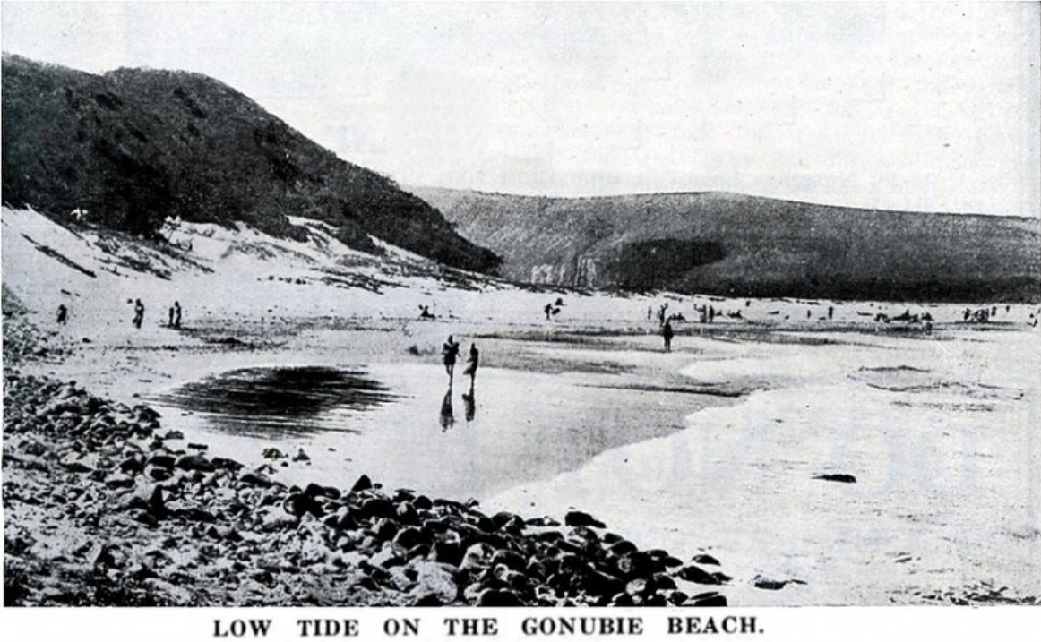
Photo credit: Hilton T
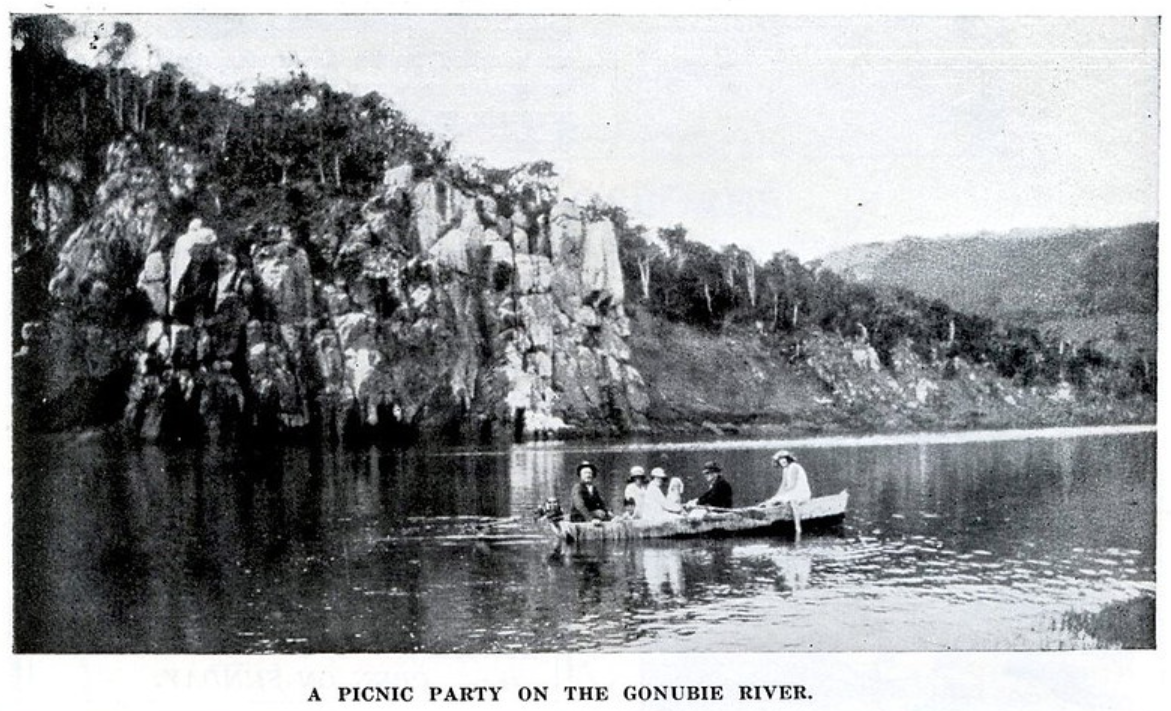
Photo credit: Jana Cooper
Photo credit: Jana Cooper
Photo credit: Jana Cooper
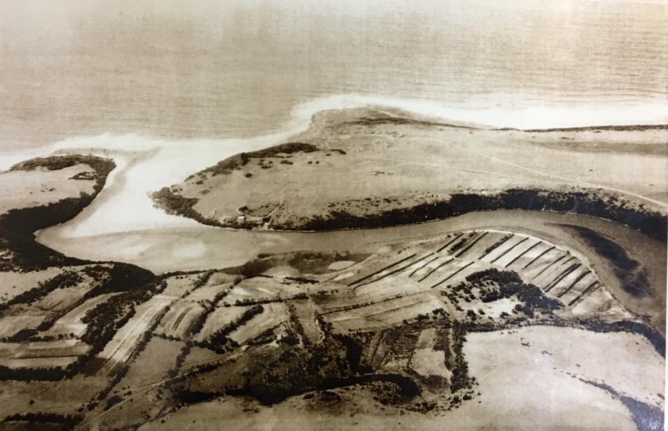
Photo credit: Jana Cooper
Photo credit: Jana Cooper
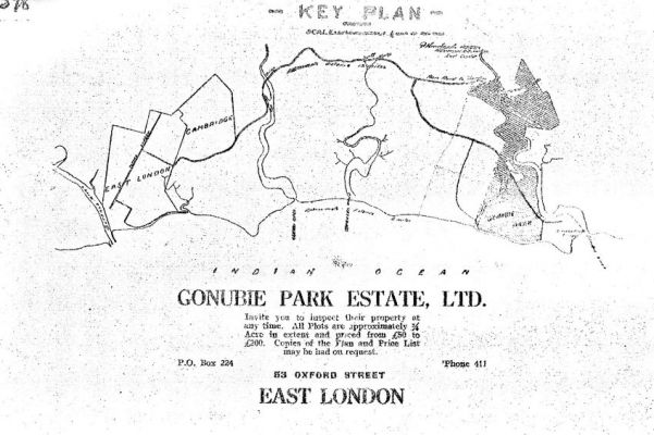
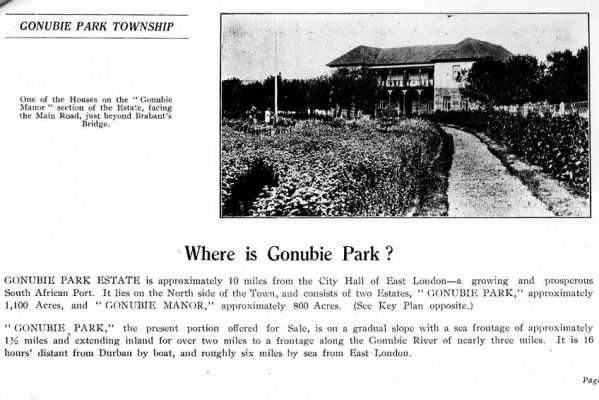
The year 1933 proved to be one of the most significant in the town’s history. This was the year local resident Louis Rosenbaum bought “Gonubie Park”. Rosenbaum decided to sell off plots and called this development “Gonubie Park Estate, Ltd.” Gonubie Park Estate, approximately 1900 acres, was divided into two sections, “Gonubie Park,” approximately 1100 Acres, and “Gonubie Manor,” approximately 800 Acres. Gonubie Park was the land that was for sale. This was to be the beginning of residential development in the town. All plots were approximately a quarter Acre in extent and priced from £50 to £200. Copies of the plan and price lists could be had on request and picked up from No 53, Oxford Street, East London in those years (Source: Gonubie Manor History).
In his advertising campaign, Rosenbaum described that these plots were on a gradual slope with a sea frontage of approximately one and a half miles and extended inland for over two miles to a frontage along the Gonubie River of nearly three miles. It was 16 hours distant from Durban by boat, and roughly six miles by sea from East London.
Strategically located, GONUBIE PARK TOWNSHIP will offer in a few years the finest examples of: “I could have bought at a third of that price!!!”
Safeguard against this by investing now in –
GONUBIE PARK TOWNSHIP
“East London’s Better Half.”
Source: Gonubie Manor History
Source: Gonubie Manor History
Source: Gonubie Manor History
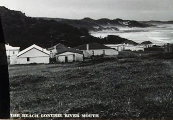
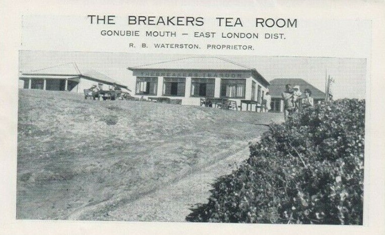
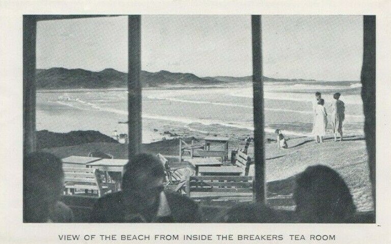
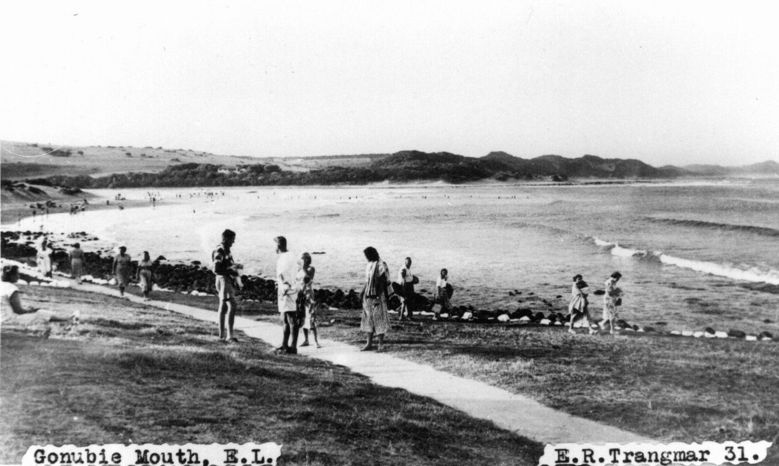
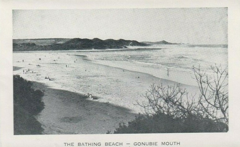
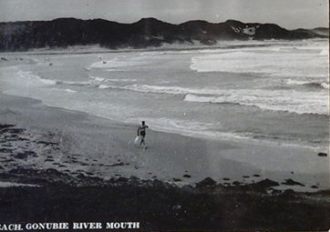
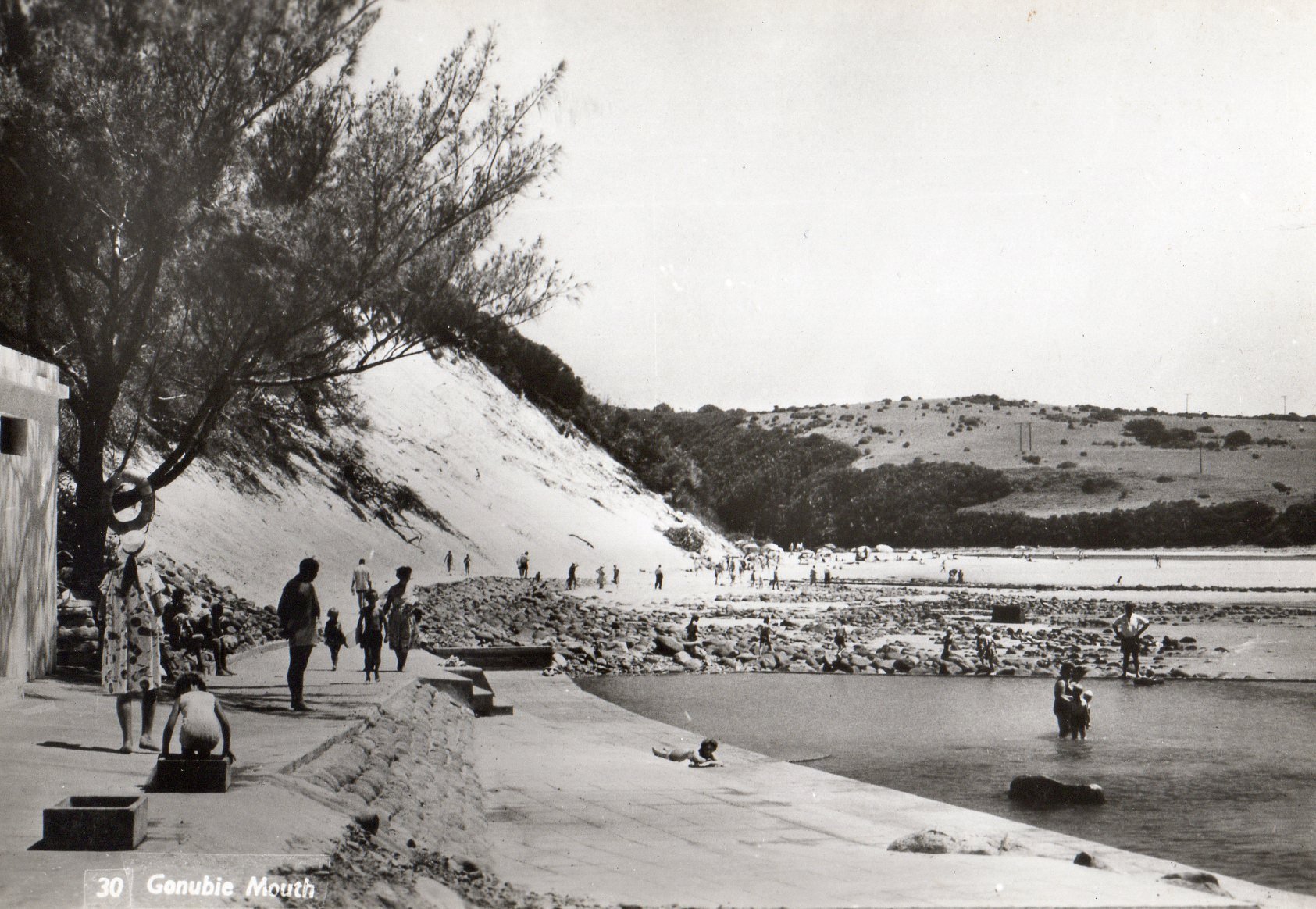
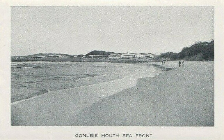
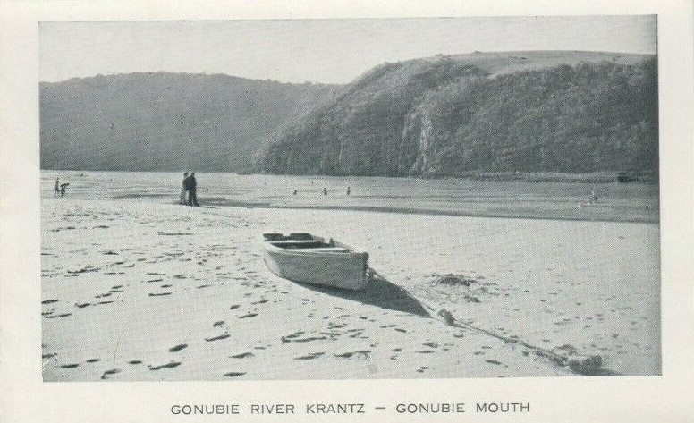
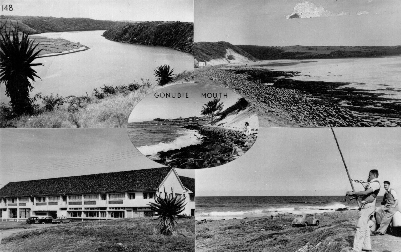
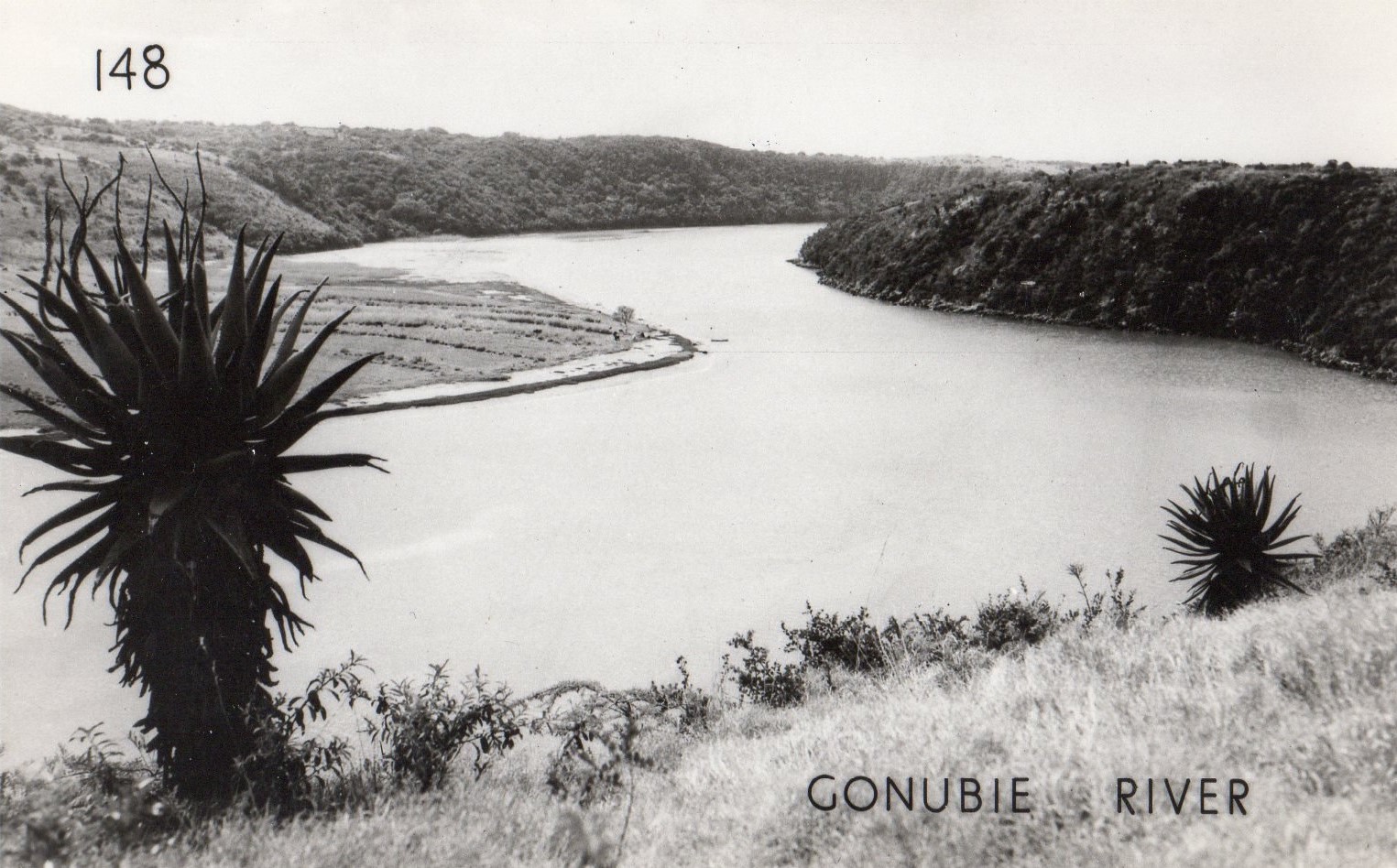
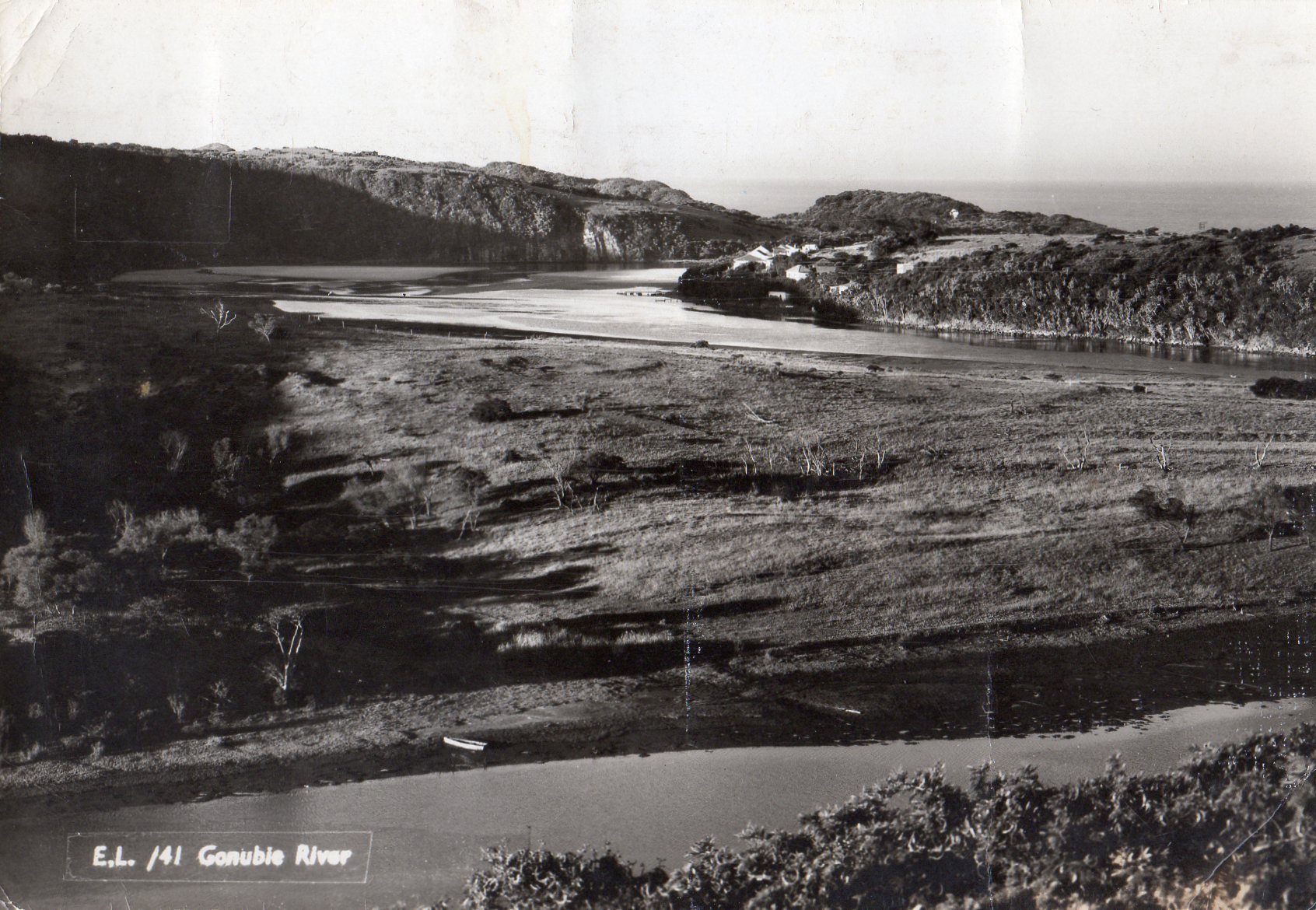
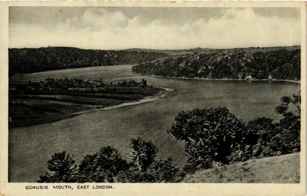
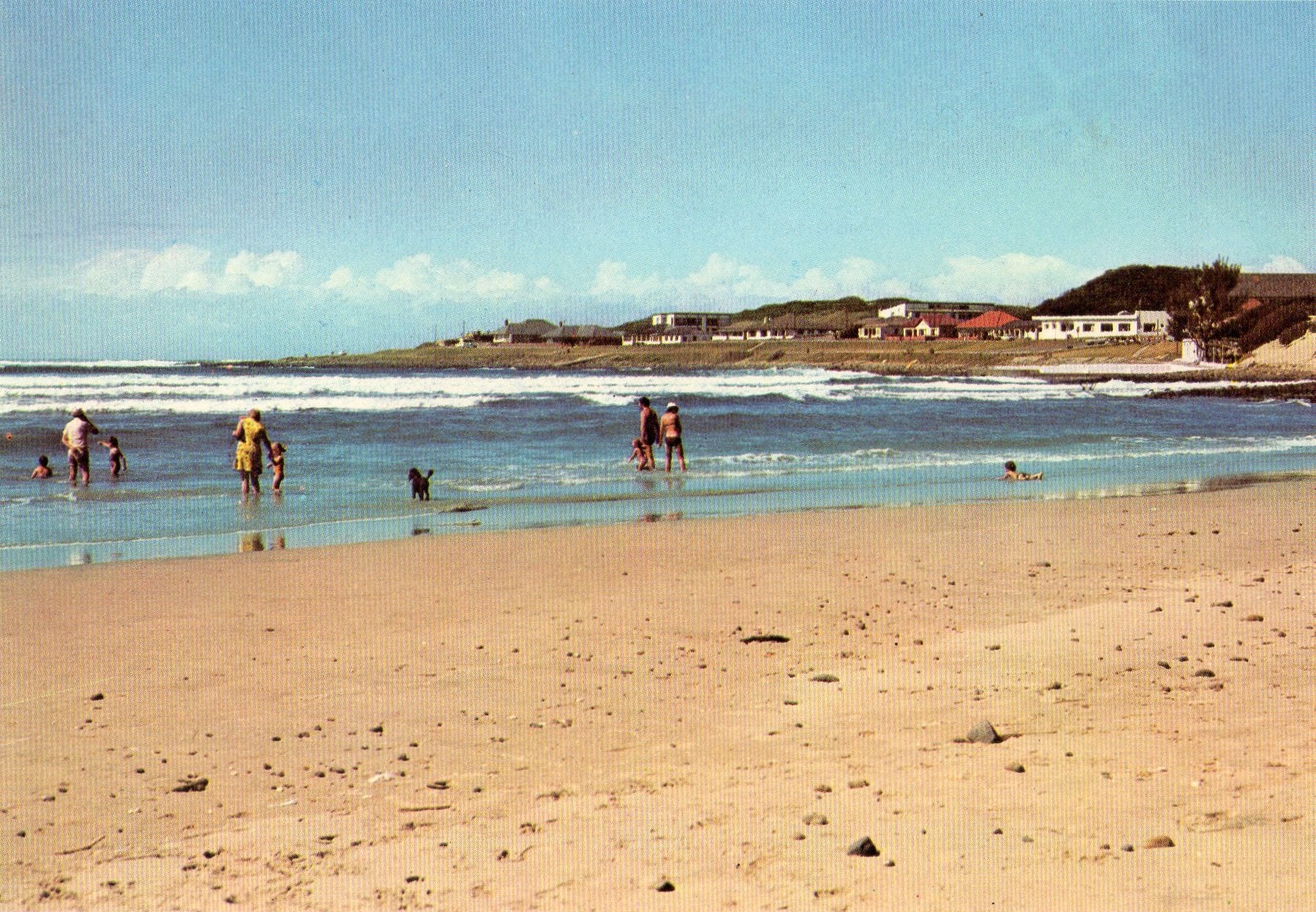
During 1950 electricity was laid on and in 1953 a village management established. The 50s proved to be a big boom in the village’s development with many new residents flocking to this piece of paradise. The postcards below show how Gonubie evolved during this period.
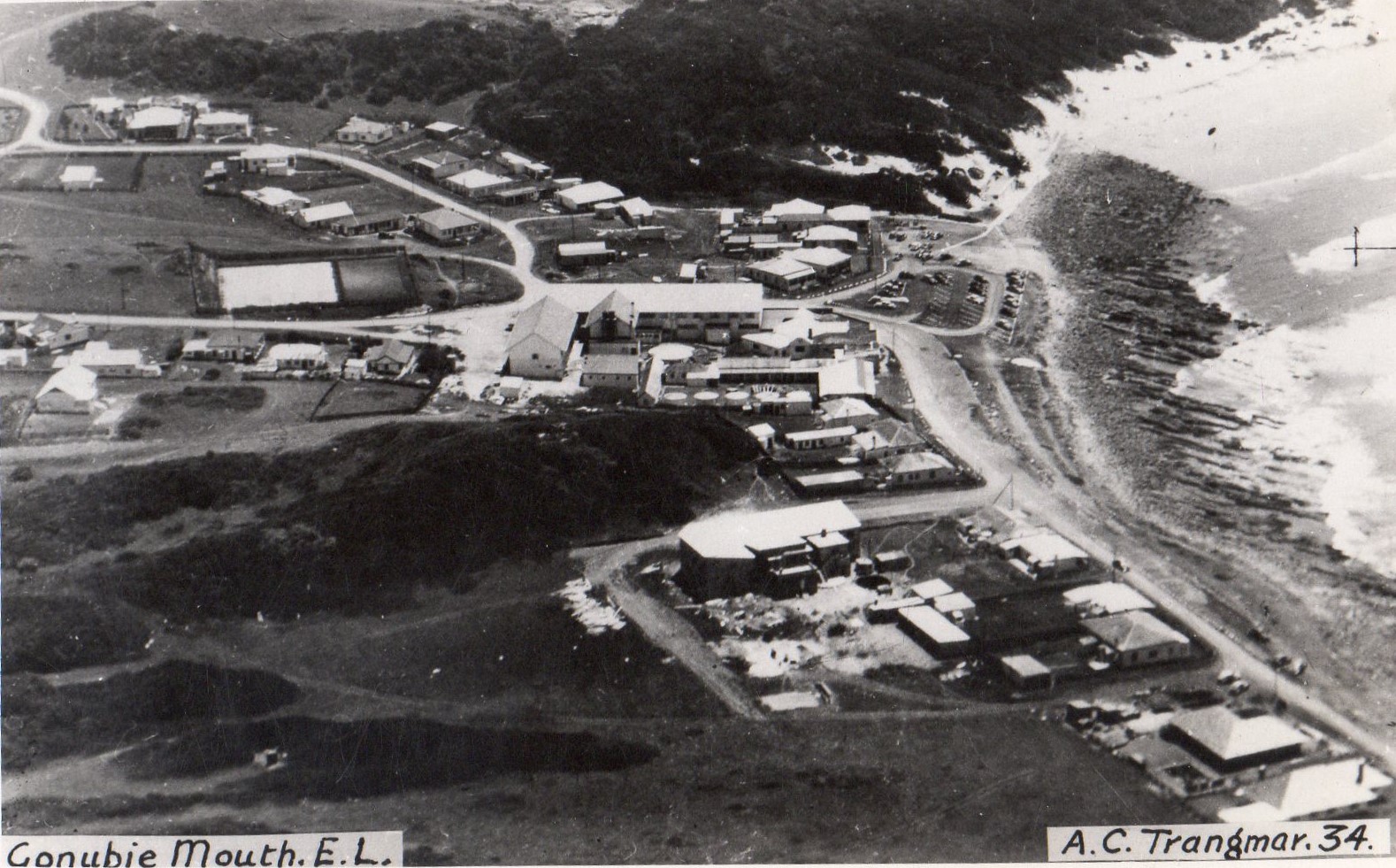
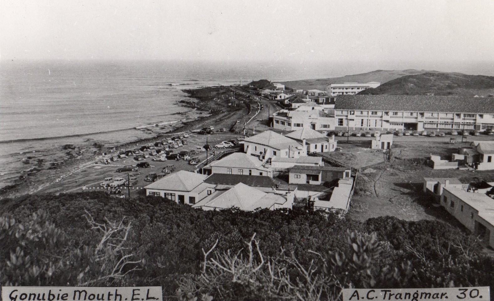
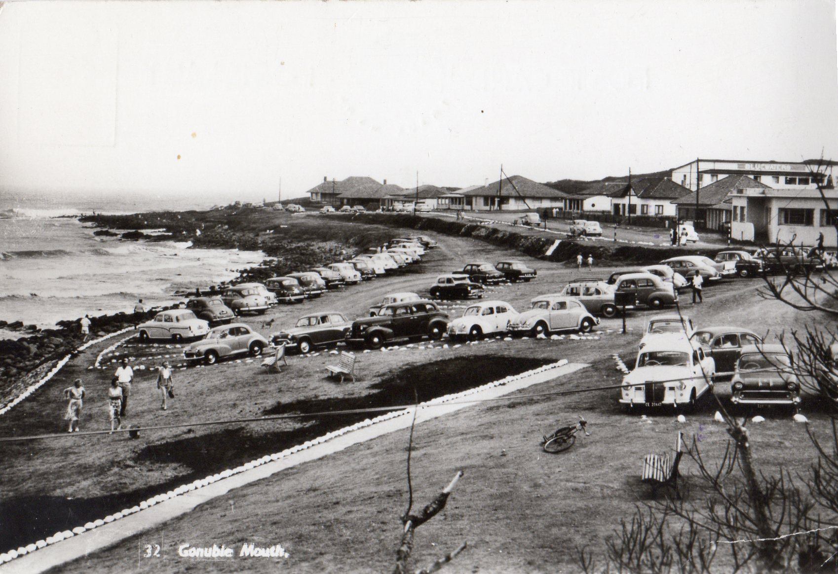
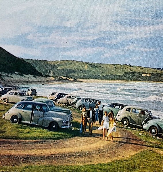

Photo credit: E.L. Camera Shop
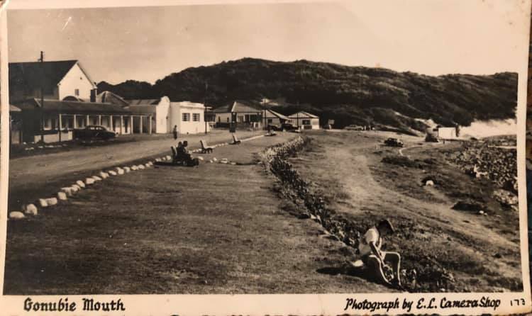
Photo credit: Belinda Garb Schwartz
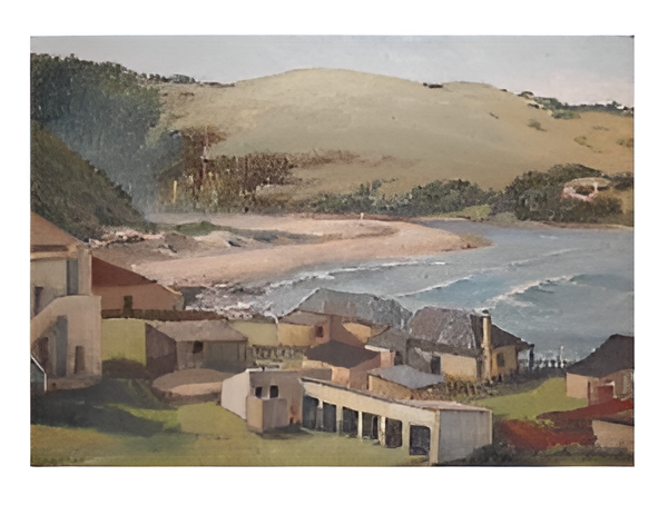
Ivan Vincent created this oil painting of Gonubie Mouth around the same time. Here we are provide with some colour to bring times past to life:
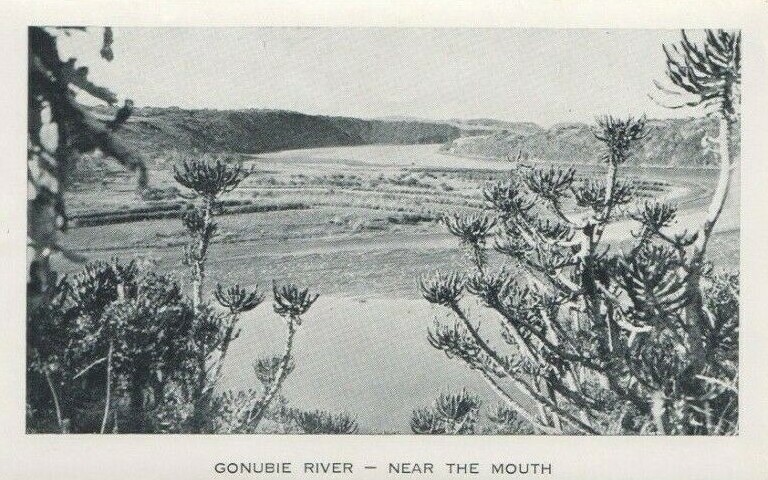
And then of course one cannot exclude the natural beauty along the Gonubie river.
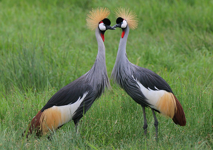
The Gonubie Nature Reserve (also known as the bird sanctuary) was established in 1955 to conserve a coastal wetland habitat and associated bird, plant and animal species. Today, the reserve is home to over 130 species of bird, mostly water birds such as the beautiful Grey Crowned Cranes. There is a well-established walking route and a bird hide overlooking an open body of water, which makes it ideal for birdwatchers interested in wetland species. The reserve also has a small interpretive centre with bird and animal listings and a brief history of the area. (Source: showme.co.za)
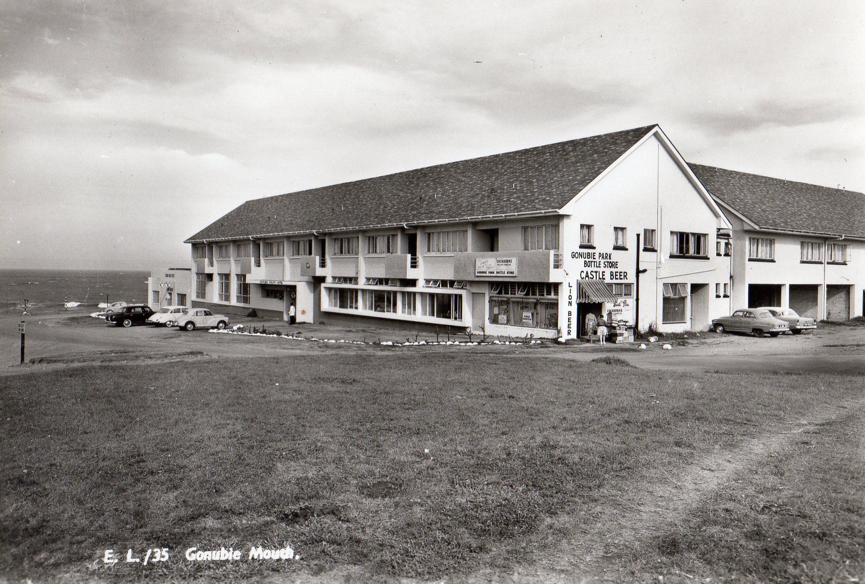
In terms of accommodation, two hotels have been around for many years, the first being the Gonubie Mouth Hotel, which is a 3 star family run hotel boasting two restaurants and 4 bars with magnificent views over the Gonubie bay. The hotel is a stone’s throw away from the beach.
There is also the Bluewaters Hotel, originally called the Bluewaters Inn, which is also uniquely situated just 30 meters off the Gonubie promenade and 50 meters from the ocean. The hotel itself has a popular pub & restaurant attached, the Slipway, where locals and guests alike come together for entertainment. A kids play centre ensures that the children are catered for and overall the place is very family welcoming. Conferencing facilities are on offer as well. The hotels website offers an excellent video, which showcases the beauty of Gonubie (click here).
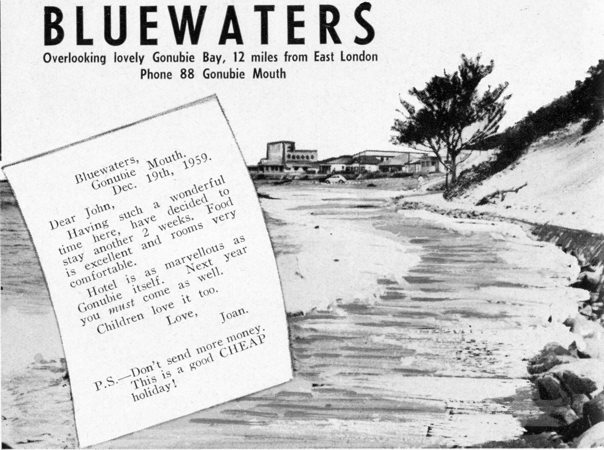
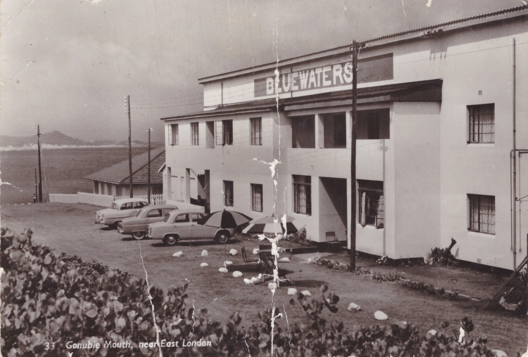
Photo credit: Chantelle Schwedhelm
Photo credit: Chantelle Schwedhelm
Alternatively, if you are up for some camping, then the Gonubie Caravan Park & Resort is great for enjoying the independence and freedom of a caravan or camping holiday. All their sites have electrical outlets and water points nearby, and most offer full or partial shade. The sites are level and are large enough to accommodate most caravans, motorhomes and tents.
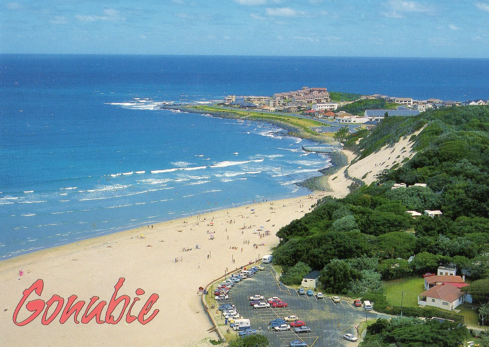
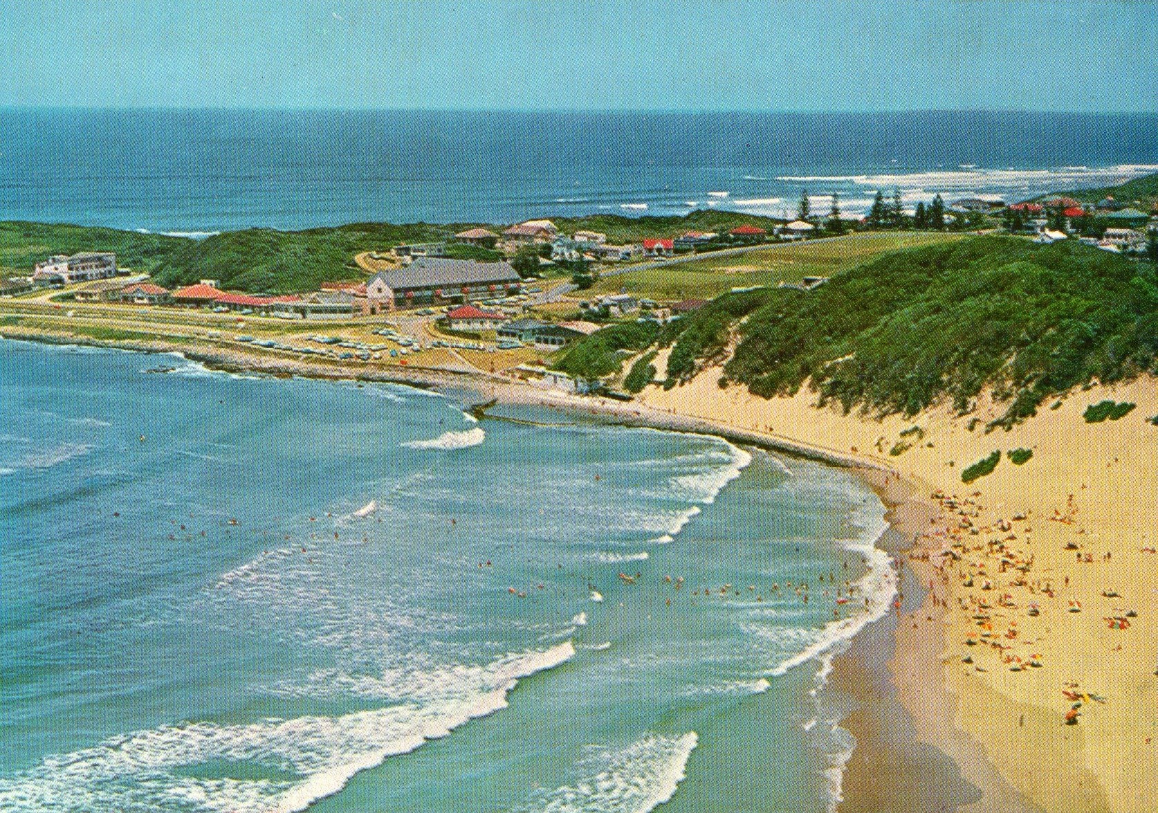
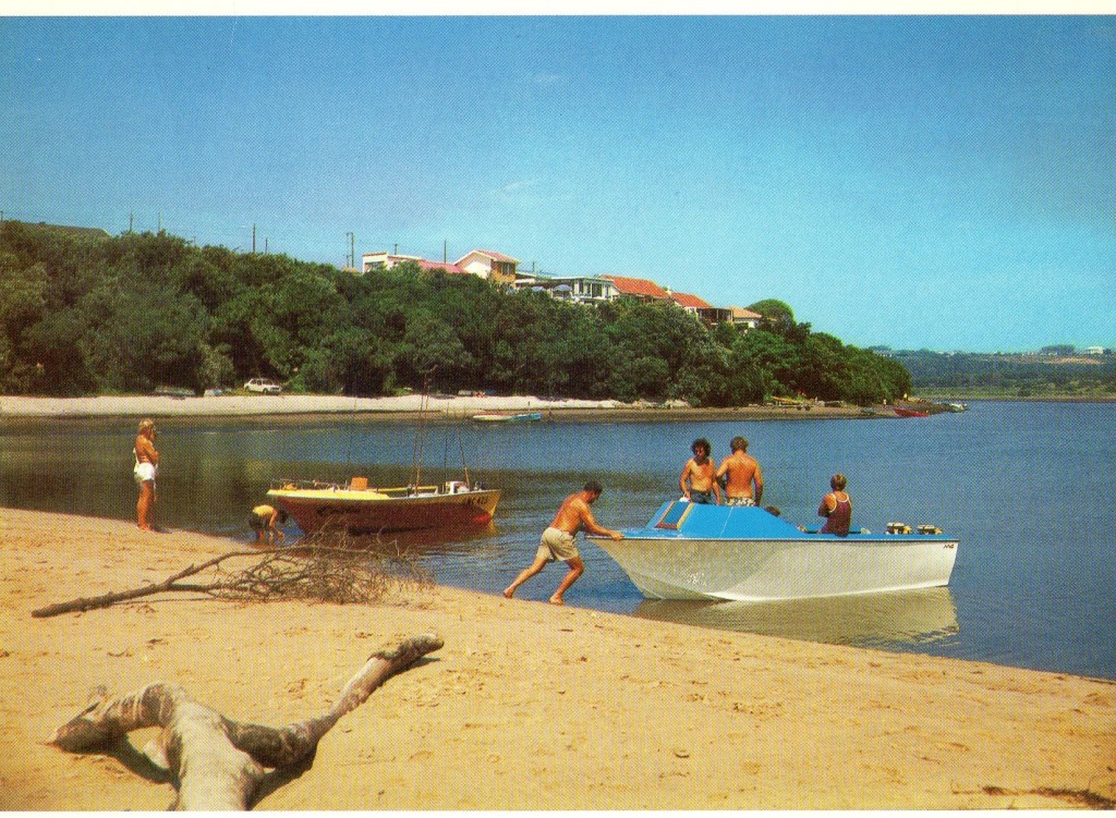
Photo credit: Mark Finnigan
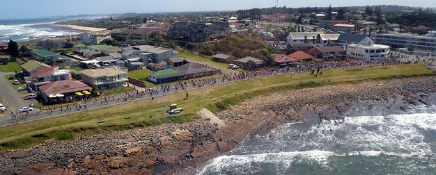
The year 1975 was when Gonubie held it’s first Surfers Marathon (known today as the Discovery Surfers Challenge), however, the first race was not as formal as it is today. “The race was born from some friendly rivalry between local athletes and surfers who frequented the same watering hole in East London. Having not fared as well as some of their road running friends in a road relay from King William’s Town to East London, the five-man surfing team came in for a fair bit of ragging. Seeking retribution, the surfers issued a challenge to the roadrunners to meet them on their turf – the beach – and set about planning a route taking in the sand, rocks, loose boulders and rivers between two points. The first race, which stretched for about 1 kilometer further that the current one, began with just 36 enthusiastic runners. To further rub salt into the wound, the race was won by one of the runners! However, the stage was set for what has become one of the most sought after marathon cum obstacle courses in the country. The race has stayed in the hands of the surfing fraternity ever since and currently boasts an entry base of between 1500 and 2000 participants every year.” (Source: Discovery Surfers Challenge – History of the event).
Source: showme.co.za
The informal settlement of Mzamomhle was established in 1987 and was situated on sandy soil, on the coast, which was not environmentally suitable for settlement. “During apartheid South Africa, non-white races had no security of tenure or any significant property rights. All were relocated in 1989 from the farms on which they were born, to the new township of Mzamomhle. A city official, Rodbey Bouwer, confirmed the date but could not comment on politics and history behind the relocation. It is interesting to note here that of all the libraries searched, there is no written history on Mzamomhle.” (Mfundiso Mahlasela and Gary Minkley, 2006). According to Garth Petzer, “Mzamomhle was not the first Xhosa township. The first existed below the present police station and not too far from the municipal workshops. It was a tidy, well organised little community with corrugated iron dwellings and a Methodist Church just next to it. It was in 1977/8 the homes were forcibly demolished and people evicted. Mzamomhle was justifiably sited just a mile further down the little stream from that site.”
Over the years to follow, South Africa became a free Democratic nation in 1994 and Gonubie began to grow immensely. According to a 2011 Census, Gonubie has about 11471 residents, who reside in the lower income area of Mzamomhle, the middle income area of Riegerton Park, and the majority of the residents residing in the middle to upper income bracket Avenues and Streets. Gonubie has 18 avenues and 12 streets. There is also the lavish riverside area, which is a popular tourist destination.
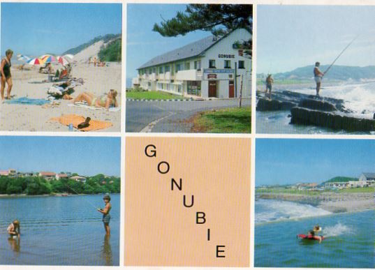
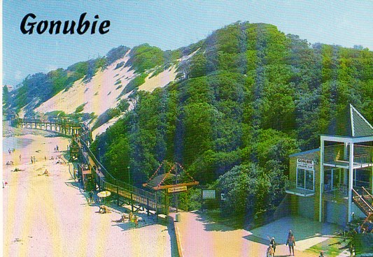
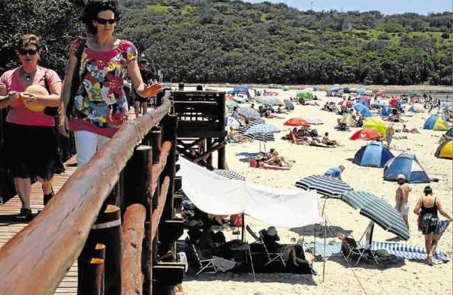
Gonubie Beach is one of the best kept secrets of the Sunshine Coast. The beach can be found at the mouth of the Gonubie River, as it enters the ocean, with hillsides covered in lush vegetation and only a few houses peeking through. The beach has a unique access point along a 500m raised wooden boardwalk of international standard, built in 1992 to protect the primary dunes from human traffic. This impressive boardwalk leads down to a tidal pool and eventually arrives at a beautiful sandy beach. The boardwalk is a fantastic vantage point for spotting passing whales and pods of dolphins, as well as surfers, bodyboarders and windsurfers. There are facilities for the handicapped, as well as Buffalo City Municipality (BCM) lifeguards on duty throughout the year from 8.30am to 5pm in the evenings. During the December period, more lifeguards are added and they’re on duty from 7am to 6pm. Popular surfing spots are located towards the tidal pool and at Gonubie point. There is also a boat launching site next to the beach. The lagoon is wonderful and calm – a fantastic place to muck about. To add to that the perfect swimming conditions from the warm waves of the Indian Ocean and the superb natural scenery along the boardwalk and it’s easy to understand how time can pass here without complaint.
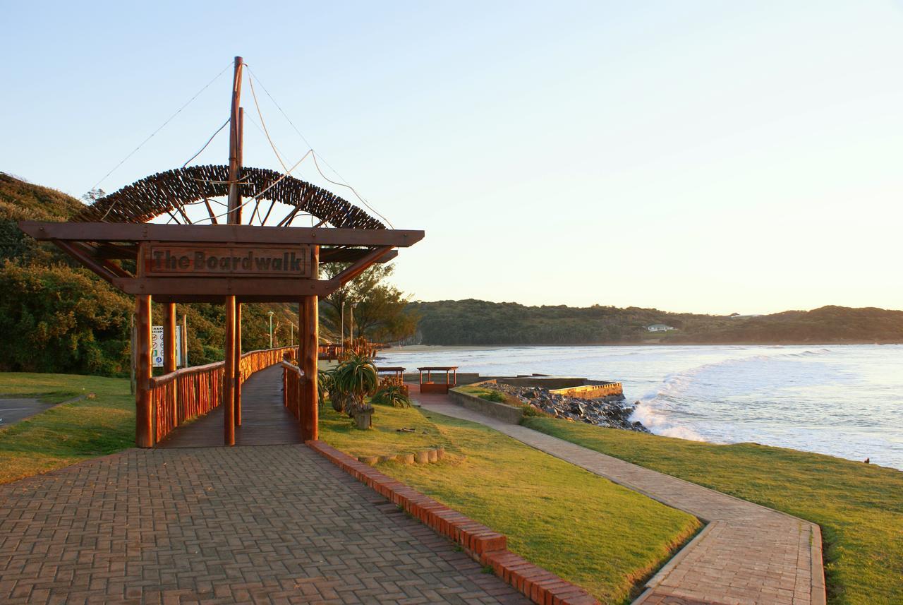
Photo credit: Danie van der Merwe

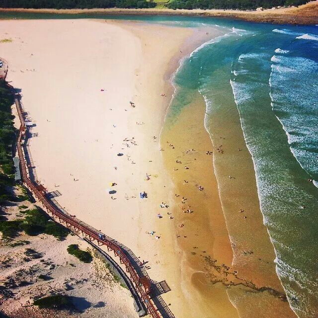
Photo credit: Wilfred Van Zyl
In 2004 Gonubie Beach gained pilot Blue Flag status, but lost it in 2007 due to poor water quality. It regained the coveted status again in 2009, only to lose it again four months later because BCM officials failed to submit water samples within the allocated time. Blue Flag beaches are required to submit water samples once a month in order to retain their status. The Blue Flag status is awarded to beaches based on water quality, environmental education and information, environmental management, and safety and services. The prestigious but hard-earned Blue Flag is a powerful drawcard for tourists around the world. At the time, Tourism Buffalo City CEO Peter King said it was disappointing news “since the tourism industry uses this status as a marketing tool to promote the attractiveness of the region”.
Source: Dispatch Live, 2016.
Gonubie’s estuary coupled with the flourishing vegetation on adjacent sand dunes alone is enough to place it in a league of its own. “The Gonubie River offers Flyfishing from the bank and from the boat. The Main species to be found are Kob, River Skipjack, Garrick and Grunter with the odd Shad, Kingfish, River Snapper and Barracuta.The Best time of the year is Spring and Summer. Hot spots on the river are the Drop-off, Schwedhelms, Rocky Bank, Red Cliffs and the Top Pool. The best time to fish the river are on an outgoing tide and two hours on the pushing tide. Start at the top of the river and move with the tide to be at the Drop-off about one hour to full low. Kob are found from the Drop-off to Rocky Bank. Garrick frequent the Drop-off and Schwedhelms. River Skipjack are found at Top Pool, Rocky Bank, Schwedhelms and the Drop-off. Grunter can be targeted at the various prawn beds along the river banks. Access to the river is from the beach, tide waters and the estuary, the latter being private property so permission must be required.” (Source: http://www.fishingowl.co.za/swvenue.html).
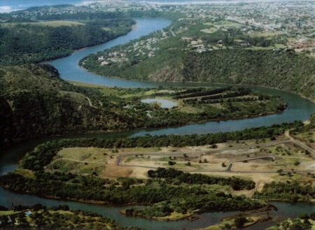
Photo credit: Wilfred Van Zyl
Things are relaxed here and letting go of tension is easy when the beach and lagoon offer hours of tranquility and sunshine pleasure. When the tide is out, the lagoon is a perfect place for exploring – collecting shells, discovering birds, small fish, hermit crabs and other marine creatures and, particularly for families, an ideal place to while away the time. Furthermore, the river serves as a great place for activities such as canoeing and kayaking.
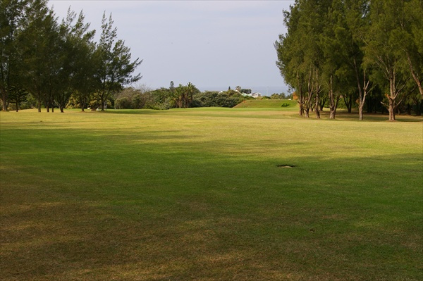
“In addition to the beach, a round of golf at the Gonubie Golf Course with its excellent facilities is a must for visitors and golfing enthusiasts” (Jacobs, 2012). The Gonubie Golf Course is a parkland country layout course and is challenging as there are 9 greens with 18 different tee boxes in different positions. You have to hit the ball straight from the tee box otherwise you have to accept a drop shot on each hole, a great test of golfing ability. (Source: encounter South Africa – Gonubie Golf Club).
Even your need to restock the coffers is adequately met by the local Spars and recently opened King’s Mall at the corner of Gullsway Road and Main Road. This modern new shopping mall was built in the modern style of the indoor/outdoor lifestyle centre. This style enables the architect to create a unique flow of features with a combination of open walkways as well as indoor and outdoor line shops.
For a small town, Gonubie has everything one needs, including: a primary and a high school with excellent academic and sporting facilities, a Christian school for an alternative form of schooling, multiple doctors, a local pharmacy and a Clicks, a veterinary clinic, a police station, a traffic department, a library, a post office, a butchery, multiple petrol stations and a number of modern shopping complexes offering a wide variety of popular clothing and food stores. There’s a flea market or two every Saturday in front of the library and the anticipated annual Gonubie Christmas Fair takes place at the Gonubie Sports Field, holding various fun filled activities to keep families entertained all day long. Furthermore, the Gonubie Marine Club, for deep sea fishing enthusiasts, holds monthly Steak Evenings. and the Gonubie Sports club offers many sporting facilities such as tennis courts, squash courts, a lawn bowls pitch and cricket nets.
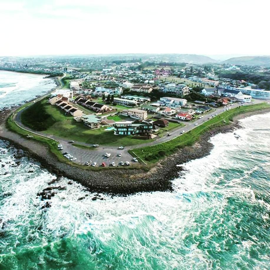
Apart from the natural beauty, one of the main attractions of living in the area is that no industrial development is planned, ensuring that this little piece of paradise remains just that. The cover photo of this article, taken by Wilfred Van Zyl, is a beautiful rendition of Gonubie, captured in all its glory.
When wanting to go out to for a bite, Gonubie offers some fine local restaurants; the prefect breakfast/ lunch is had alongside the sea at the Heavenly Pancake House. For supper time, Guido’s restaurant is recommended for their delicious pizza, which is baked in traditional wood burning ovens. They also offer tasty pastas, schwarmas, steaks and seafood. Or perhaps you just want to indulge in a local Shamrock pie from the petrol station and a Steri Stumpie milkshake to wash it down.
Whenever Gonubie is faced with difficulty, the community comes together and ‘makes a plan’. Gonubie is well established in the world of social media, many groups exist on Facebook, including: Gonubie Home of the legends, Gonubie Marine Club, Gonubie Hotel, Gonubie Primary School, Gonubie Project Neighbourhood Watch, etc. One particular group called Nubians Unlimited has united the community and through their efforts have managed to preserve the beauty of this wonderful town when faced with difficulties. An example of this was when Superspar Gonubie kindly opted to repair and paint all the damaged white fence poles along the area between the Boardwalk and Gonubie Point, which were damaged during new years day celebrations. This community group gathered residents together and assisted in the repair and painting of the white poles.
This small coastal town has certainly grown over the years and will no doubt continue to increase in size with the new expansion of the Gonubie Main Road. Gonubie is fast becoming a ‘hot property’ spot and holiday homes in particular are popular. Although Gonubie is considered to be a suburb of the city of East London, the chilled vibe and awesome scenery of Gonubie belies this. Lying on the estuary of the Gonubie River and enjoying a wonderful climate, Gonubie is a small piece of paradise on the Eastern Cape Coast and will remain so for many years to come.
 These streets hold my deepest days, this town taught me golden ways, and for this I will always hold a special place in my heart for GONUBIE
About the Author
Born in East London, South Africa, Dayne Skolmen developed a passion for writing articles in his early 20s. His favourite subjects to write about are interesting people, places, and items from the past. With every article he writes, he discovers all the details about his subjects and pieces them together to form a brief history for you to enjoy.
For more wonderful articles visit Dayne’s Discoveries Blog, like Dayne’s Discoveries Facebook Page to keep updated with new publications, or Contact Dayne to share any information, stories, or photographs relating to Gonubie.

What a beautiful place to live, we in the Caravan park, we own a parkhome, so peaceful, safe and secure, this is heaven….
LikeLiked by 1 person
Fascinating to read. My family owned and lived in Blue Waters Inn/Lodge/Hotel (1995-2003) so it was amazing to see the old photos. I believe that the Post Office was originally where the pub is now. Do you have any info on that?
LikeLiked by 1 person
What a wonderful read. Thank you!
LikeLiked by 1 person
Great article Dayne. It is great to learn about new places that we never heard of especially from people who love history like you. Thanks for sharing !
LikeLiked by 1 person
Thanks Dannyboi, very interesting read😃
LikeLiked by 1 person
Excellent !
You might add – the Johannesburg firm of estate agents – G.E.Symon & Co – built the Gonubie Hotel which was still in existence in the ’40’s and early ’50’s.
An early memory of mine reactivated by the article was of the fishermen who used to ‘kite fish’ for whale sharks off the rocks in front of the hotel which, to my chagrin now, was most thrilling.
Notwithstanding, my wife (unknown at the time) and I spent many happy hours at Gonubie and the article revived many happy memories of the spot.
LikeLiked by 1 person
Well done Dayne!!!! We are in Gonubie since 1982. It is so nice to read the history of wonderful Gonubie before 1982. Would you mind if I share your blog on Dalena Properties’ website?? Thanks. Dalena
LikeLiked by 1 person
Hi Dalena. Thank you for taking the time to read my article, I am glad that you enjoyed it. I do not mind at all, please share away 🙂
LikeLike
Lovely to see photos and read about this town we have loved, since coming here to live in 1981. It is part of our history too! Thank you, I will send this article onto friends who have enjoyed holidays here.
LikeLiked by 1 person
Skolman! Awesome piece bruh….Really enjoyed that
LikeLiked by 1 person
Thanks bru. Glad you enjoyed it 🙂
LikeLike
Excellentbnow manybof my family and friends can see why we love Gonubie !!
LikeLiked by 1 person
Wonderful read, thank you. This brings back many great memories.
LikeLiked by 1 person
Another thought on the article. Obviously our political past is going to play a role for some years to come but I feel that it must be pointed out here that the inference about there being no written mention of a large lower income group is hardly the fault of the government of the time. The reality is that returning Africans had a written tradition whereas no record has to my knowledge, ever been kept in written form by the people who were here previously. Their traditions based on patriarchal lore were passed down from father to son or mother to daughter. It is important to make this point because whites came with the schooling and histories etc of the Nortern Hemisphere and the well heeled and educated amongst them kept diaries and passed this information back to the friends and family they left behind.
This does not mean that the “natives” they found did not have a similar system, simply that they preferred to convey it differently. Traditionally this is why the various customs took place when couples wished to marry for example and why ancestry is still as important to them as it is to us. isiduko resides in the memories of the elders usually males but also females. The recolonization by our white ancestors and imposition of what was familiar in terms of laws and acquired skills was part fear resulting in self defense by superior arms. Sadly many of the natives elders lost their lives and with them went some of their vital history.
Northern descendants of African peoples have much to answer for!
LikeLike
Hi Gail.
Thank you for your input. I have updated the article in line with the information you have provided. Please read over the section again and let me know if I have conveyed your point in the correct manner.
LikeLike
Great read. Well done.
LikeLiked by 1 person